
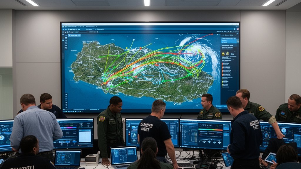
In an era defined by intensifying climate volatility and unpredictable weather patterns, the Office of Disaster Preparedness and Emergency Management (ODPEM) is taking a decisive step toward digital transformation. By actively developing new digital platforms designed to synchronize relief efforts, ODPEM is moving away from legacy, fragmented reporting methods toward a unified, real-time command structure. This modernization initiative, highlighted by recent reports from the Jamaica Information Service, signals a fundamental shift in how Jamaica manages crisis response, moving from reactive coordination to proactive, data-driven resilience.
Key Highlights
- Unified Digital Infrastructure: ODPEM is implementing a centralized digital framework to consolidate disaster-related data across multiple agencies.
- Real-Time Resource Deployment: The new platforms are engineered to identify critical resource needs and route assets more efficiently during emergencies.
- Enhanced Situational Awareness: By utilizing improved geographic and logistical tracking, ODPEM aims to reduce response times by eliminating information bottlenecks.
- Inter-Agency Interoperability: The systems are built to bridge communication gaps between national, parish-level, and municipal response teams.
The Digital Evolution of Jamaican Disaster Management
The traditional landscape of disaster management is often hampered by the ‘silo effect,’ where different agencies—from the Jamaica Defence Force to local parish councils—operate with disparate data sets. ODPEM’s recent initiative to develop these digital platforms is not merely a software upgrade; it is an organizational restructuring disguised as technological integration. At the core of this effort is the desire to establish a ‘single source of truth’ during active emergencies, such as hurricanes, earthquakes, or flooding events.
Overcoming Data Fragmentation
Historically, the challenge during a disaster in Jamaica has not been a lack of effort, but a lack of visibility. Field reports often struggle to travel from remote coastal communities to central decision-makers in Kingston. The new digital platforms are being designed to ingest data directly from the field, whether it be via mobile applications or automated sensors. By creating a digital dashboard that updates in real-time, ODPEM ensures that stakeholders have a live view of the situation as it evolves. This level of granularity is vital for making high-stakes decisions, such as where to position emergency shelters or when to mobilize search and rescue assets before a weather system makes landfall.
The Strategic Integration of GIS
Geographic Information Systems (GIS) play a central role in this rollout. By layering geospatial data—such as topography, infrastructure vulnerability, and population density—over real-time weather tracking, ODPEM can essentially ‘wargame’ the impact of a disaster before it happens. This predictive capability allows for the pre-positioning of food, water, and medical supplies in areas statistically likely to be cut off from main logistics routes. The digital platform serves as the nervous system for this operation, ensuring that the right resources arrive at the right coordinates at the right time.
Strengthening The Last-Mile Connection
One of the most ambitious aspects of this program is the focus on the ‘last mile.’ Often, national response plans excel at high-level coordination but falter when it comes to the specific needs of smaller, rural municipalities. These new digital tools provide local parish disaster committees with a direct line to the national command, allowing them to log specific requests for resources that are immediately visible to central planners. This transparency reduces the lag between a localized request for aid and the activation of national-level logistics.
Secondary Angle 1: Economic Resiliency and Supply Chain Stability
The economic impact of disasters is often measured in the immediate aftermath by the damage to infrastructure. However, the long-term economic cost of slow relief and supply chain disruption is significantly higher. By digitizing the logistics chain, ODPEM is also safeguarding Jamaica’s economic continuity. Businesses, particularly in the tourism and agricultural sectors, rely on the rapid restoration of roads and utilities. A more efficient relief response means faster recovery times, which directly correlates to a more resilient national GDP and lower insurance-related inflationary pressures post-disaster.
Secondary Angle 2: Building Resilience Against a Changing Climate
The Caribbean region faces an increasingly hostile climate profile. The intensity of storm seasons has forced emergency management bodies to rethink traditional contingency plans. ODPEM’s digital initiative recognizes that ‘normal’ is a moving target. These platforms are scalable, allowing for the integration of new climate modeling data. As weather patterns become more erratic, the flexibility of a digital platform allows for continuous refinement of evacuation protocols and hazard modeling, ensuring that the agency remains one step ahead of the next major weather event.
Secondary Angle 3: Navigating Cybersecurity and Data Sovereignty
With the shift to digital platforms comes the imperative of cybersecurity. Disaster management systems contain sensitive data, including vulnerable population mapping and critical infrastructure locations. As ODPEM integrates these digital tools, the focus on data integrity and security is paramount. Protecting this data from external interference, while ensuring accessibility during grid-down scenarios, is a complex technical challenge. The development phase includes robust protocols for offline-capable synchronization and data encryption, ensuring that even if the internet infrastructure is compromised, the coordination network remains resilient.
FAQ: People Also Ask
Q: What specific technology is ODPEM utilizing for these platforms?
A: While specific proprietary software details are often classified for security, the initiative leverages advanced GIS technology, cloud-based data aggregation, and mobile-responsive reporting interfaces to ensure interoperability between field units and central command.
Q: How does this change the role of the average citizen during a disaster?
A: The goal is to create more accurate public advisories. By having better data, ODPEM can provide more precise, location-specific instructions, reducing mass panic and ensuring that those in the highest-risk zones are prioritized for assistance.
Q: Will these platforms be accessible to non-governmental organizations (NGOs)?
A: Inter-agency cooperation is a cornerstone of this initiative. By providing a unified interface, ODPEM aims to streamline how NGOs and private sector partners contribute to relief efforts, ensuring that private donations and volunteer efforts are directed to where they are most needed, thereby reducing duplication of effort.