
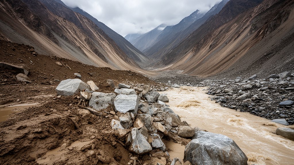
Flash flooding along the rugged, high-altitude border between Nepal and China has resulted in a staggering humanitarian crisis, with 469 confirmed deaths and over 1,500 individuals currently listed as missing. As search and rescue teams brave the treacherous, debris-choked mountain terrain, authorities have issued urgent evacuation orders amid mounting fears of secondary disasters caused by a newly formed lake upstream. The situation remains fluid, with communication networks in the affected border zones severely compromised.
Key Highlights
- Confirmed Death Toll: Official reports currently confirm 469 fatalities, with the number expected to rise as search operations penetrate deeper into isolated river valleys.
- Missing Persons: More than 1,500 people remain unaccounted for, complicating the efforts of local, national, and international aid agencies coordinating the recovery.
- Secondary Threat: A significant volume of water has been dammed by landslide debris, creating an unstable upstream lake that poses an imminent threat of catastrophic breach.
- Search Constraints: The operation is severely hampered by inaccessible topography, lack of heavy machinery access, and continuous weather volatility in the high-altitude region.
The Himalayan Crisis: Navigating an Unfolding Disaster
The recent flash flooding event along the Nepal-China border is being described by climatologists and disaster response officials as a direct consequence of shifting glacial landscapes. The rapid inundation of low-lying valleys has effectively severed access to several remote border communities, transforming the area into a logistical nightmare for first responders.
The Mechanics of the Disaster
Preliminary analysis from geological teams suggests that the flash flood was not a standard weather-related event but a Glacial Lake Outburst Flood (GLOF) combined with massive, rainfall-triggered landslides. The region, characterized by steep, unstable mountain slopes, has experienced unseasonably heavy precipitation, which saturated soil layers that were already weakened by permafrost thaw. As these slopes gave way, they funneled millions of tons of mud, rock, and ice into the river systems below, creating a wall of debris that obliterated infrastructure in its path.
For the survivors, the disaster is far from over. The primary concern is the integrity of the debris dam forming upstream. Should the blockage fail, a secondary wave of water and sediment could strike settlements that have already been decimated, effectively nullifying the current efforts to locate survivors. The Department of Hydrology and Meteorology, in coordination with Chinese border authorities, is monitoring the water levels using satellite imagery, as ground access remains physically impossible in many areas.
Challenges in Search and Rescue Operations
The scope of the search operation is unprecedented for this specific mountainous zone. Rescue teams, including specialized mountaineering units and paramilitary forces, are currently operating on foot, as the destruction of bridges and arterial roads prevents the use of heavy trucks or construction equipment.
“The sheer scale of the debris is the primary obstacle,” noted a coordinator from the local disaster management committee. “We are searching for 1,500 missing people in an area where the topography has been physically altered by the landslide. Landmarks have disappeared, and the river paths have shifted. We are essentially searching for needles in a haystack of mud and granite.”
Strategic priorities are currently focused on ‘golden hour’ recovery efforts, shifting toward stabilization of the river banks and attempting to clear drainage channels to relieve pressure on the upstream lake. However, international aid has been slowed by the high altitude and the geopolitical sensitivities of the border region, requiring complex diplomatic clearance for search teams to operate on both sides of the frontier.
Climate Impact and Future Mitigation
The frequency of such disasters in the Himalayas has been steadily increasing, a trend that environmental scientists attribute to climate change accelerating glacial retreat. The creation of larger, more unstable proglacial lakes is becoming a standard feature of the regional climate, leading to a “new normal” of disaster readiness.
For local governments, the immediate focus is saving lives, but the long-term objective must shift toward structural mitigation. This includes the installation of early warning systems (EWS) that can detect rapid water level changes and transmit alerts via satellite to remote villages. Without such infrastructure, these border communities remain at the mercy of unpredictable, high-altitude hydrological events that occur with little to no notice.
FAQ: People Also Ask
Q: What is a GLOF (Glacial Lake Outburst Flood)?
A: A GLOF occurs when the dam containing a glacial lake fails, releasing a massive volume of water and debris downstream. These floods are extremely dangerous due to the speed at which they travel and the amount of sediment they carry.
Q: Why is the death toll so high in this region?
A: The high casualty count is attributed to the sudden onset of the flood, which struck populated valleys without sufficient warning, and the remoteness of the region, which makes rapid evacuation and medical support extremely difficult.
Q: Are international aid agencies currently on the ground?
A: Yes, aid efforts involve a coalition of local government, paramilitary units, and international NGOs, though coordination remains complex due to the border’s geopolitical nature and the logistical challenges of the terrain.
Q: What is the risk of further flooding?
A: The risk remains ‘extremely high.’ Authorities have identified an upstream lake formed by landslide debris that is inherently unstable. If this dam collapses, a secondary flood wave is likely, which is why immediate evacuation orders remain in effect for lower-lying areas.