
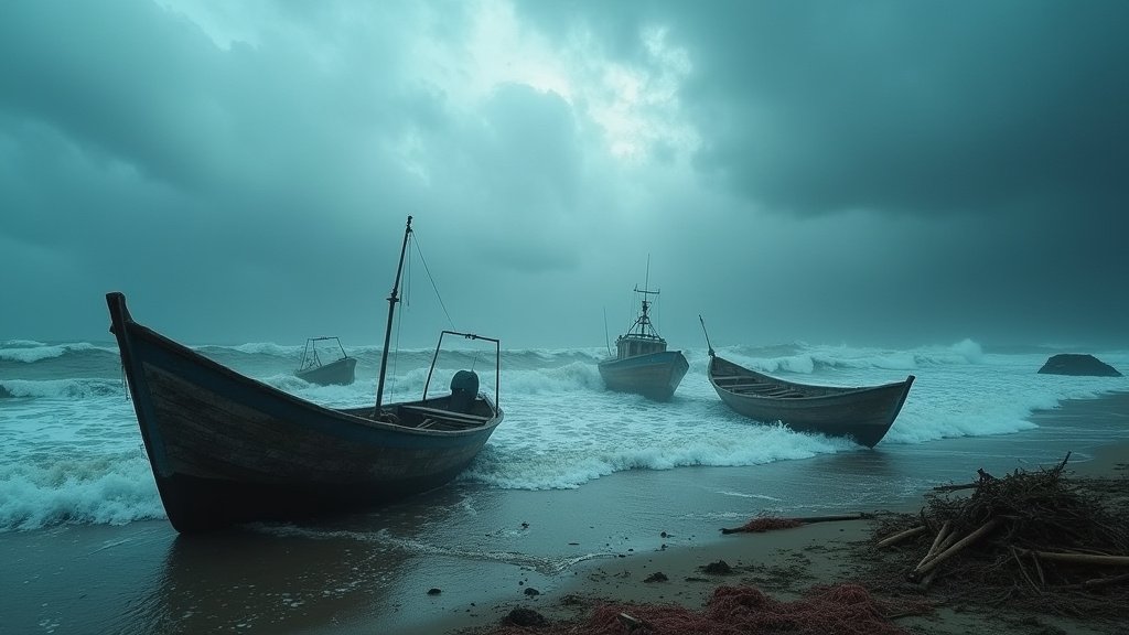
Jamaica is on high alert as the Meteorological Service forecasts a weekend of severe weather, characterized by strong to very strong winds and rough seas across the island and its territorial waters. The most critical period is anticipated to be Friday and Saturday, with the potential for gale-force winds and dangerous sea conditions impacting marine activities and coastal areas.
Intensifying Weather Systems
The powerful weather systems are being fueled by a low-level jet stream currently situated across the Caribbean Sea, a phenomenon that is expected to persist and influence the region’s weather patterns. This jet stream is contributing to the sustained windy conditions and is forecast to move closer to Jamaica, exacerbating the already severe forecasts. The proximity of these systems means that very strong, and possibly gale-force winds, will be a significant concern, particularly for the southern parishes of Jamaica and its southern marine areas, including the vital Pedro and Morant Banks.
Impact on Marine Interests and Coastal Communities
Fishers and all other marine interests have been strongly advised to exercise extreme caution. The deteriorating sea conditions, marked by rough and potentially dangerous waves, pose a significant risk to maritime operations. Authorities are urging a complete cessation of marine activities if conditions become too hazardous. Coastal communities are also being advised to prepare for potential impacts from high winds and rough seas, which could lead to localized flooding and damage.
Tropical Waves Add to the Threat
Compounding the threat from the jet stream, Jamaica is also set to be affected by a tropical wave currently located east of the island. This wave is expected to move across the island, bringing further windy conditions and rain. A second tropical wave is forecast for Friday, which is predicted to enhance the already potent wind activity. Occasional near-gale-force wind gusts are anticipated across most parishes, underscoring the widespread nature of the impending weather event.
Preparation and Safety Measures
The Met Office’s warnings emphasize the need for preparedness. Residents, especially in coastal and low-lying areas, are encouraged to secure loose outdoor items, stay informed through official updates, and have emergency plans in place. For those involved in maritime activities, adhering to advisories and avoiding the sea during the warning period is paramount. The combination of a strong jet stream and multiple tropical waves creates a challenging weather scenario for Jamaica, demanding vigilance and caution from all.
Historical Context and Future Outlook
While Jamaica is no stranger to tropical weather systems, the convergence of a strong low-level jet stream with multiple tropical waves presents a unique meteorological challenge. Understanding the dynamics of such combined systems is crucial for improving future forecasting and preparedness. Meteorologists will be closely monitoring the evolution of these weather systems to provide the most accurate and timely advisories. The persistence of these strong winds, even beyond the weekend, is a key area of focus for the Meteorological Service, as is the potential for any further development or intensification of the weather systems affecting the island.
Economic Implications
The severe weather warnings carry significant economic implications, particularly for Jamaica’s vital fishing and tourism sectors. Disruptions to fishing activities can lead to reduced catches and income for fishing communities. For the tourism industry, rough seas and strong winds can lead to the cancellation of water-based excursions and impact beach activities, potentially affecting visitor experiences and revenue. The agricultural sector may also face challenges due to high winds and heavy rainfall, potentially damaging crops.
FAQ: People Also Ask
Q1: When are the most severe weather conditions expected in Jamaica?
A1: The most severe conditions, including strong to very strong winds and rough seas, are expected to occur on Friday and Saturday.
Q2: What is causing the strong winds?
A2: The strong winds are primarily caused by a low-level jet stream across the Caribbean Sea, amplified by approaching tropical waves.
Q3: Who is most at risk from these weather conditions?
A3: Fishers and other marine interests are at high risk due to rough seas. Coastal communities and those in low-lying areas are also at risk from wind and potential flooding.
Q4: What specific marine areas are highlighted in the warning?
A4: The warning specifically mentions the Pedro and Morant Banks, as well as southern marine areas.
Q5: What precautions should be taken?
A5: Marine interests should exercise extreme caution or cease activities. Residents should secure outdoor items, stay informed, and have emergency plans. Coastal communities should prepare for potential impacts.